
|
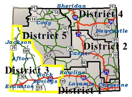
WYDOT District 3 Road Conditions
|
Frequently Asked Questions Printer Friendly Version |
|
Closures & Advisories Search Conditions By Map Search By City Search By Route Search By District Variable Speed Limits Chain Law Neighboring States |

| District Comments | |
|---|---|
| District 3 (Southwest) | WY22: Weight limit of 60,000 GVW is in effect over Teton Pass between Jackson and the Idaho state line from milepost 7 to 17. I80: The Bitter Creek Rest Area is closed until further notice EASTBOUND near Patrick Draw at milepost 144.2. |
| Interstate 80 | |||||||
|---|---|---|---|---|---|---|---|
| Town | Location | Conditions | Advisories | Restrictions | Last Report Time | Cameras | Sensors |
|
Evanston
NWS Forecast for Evanston |
EASTBOUND between the Utah State Line and Evanston | Dry | None | I 80/US 189 from milepost 5.260 to 6.260 Width restriction: 16 ft 0 in |
Jul 30, 2026, 12:30 PM |

|

|
| WESTBOUND between the Utah State Line and Evanston | Dry | None | None | Jul 30, 2026, 12:30 PM |
|
|
|
| EASTBOUND between Evanston and Exit 18, US 189 | Dry | None | I 80/US 189 from milepost 5.260 to 6.260 Width restriction: 16 ft 0 in |
Jul 30, 2026, 12:30 PM |
|
|
|
| WESTBOUND between Evanston and Exit 18, US 189 | Dry | None | None | Jul 30, 2026, 12:30 PM |
|
|
|
| Between Exit 18, US 189 and Exit 30, Bigelow Rd | Dry | None | None | Jul 30, 2026, 12:30 PM |
|
|
|
|
Lyman
NWS Forecast for Lyman |
Between Exit 30, Bigelow Rd and Exit 39, WY 412/414 | Dry | None | None | Jul 30, 2026, 12:30 PM | ||
| Between Exit 39, WY 412/414 and MM 57, Sweetwater County Line | Dry | None | None | Jul 30, 2026, 12:30 PM |
|
|
|
|
Granger
NWS Forecast for Granger |
Between MM 57, Uinta County Line and Exit 66, Granger Jct | Dry | None | None | Jul 30, 2026, 12:30 PM |
|
|
| Between Exit 66, Granger Jct and Exit 83, La Barge Rd | Dry | None | None | Jul 30, 2026, 12:30 PM |
|
|
|
|
Rock Springs
NWS Forecast for Rock Springs |
EASTBOUND between Exit 83, La Barge Rd and Exit 91, Flaming Gorge Way | Dry | None | I 80/US 30 from milepost 88.500 to 90.000 Width restriction: 10 ft 0 in |
Jul 30, 2026, 12:30 PM |
|
|
| WESTBOUND between Exit 83, La Barge Rd and Exit 91, Flaming Gorge Way | Dry | None | None | Jul 30, 2026, 12:30 PM |
|
|
|
| Between Exit 91, Flaming Gorge Way and Exit 104, Rock Springs | Dry | None | None | Jul 30, 2026, 12:30 PM | |||
| Between Exit 104, Rock Springs and Exit 111, Airport and Baxter Roads | Dry | None | None | Jul 30, 2026, 12:30 PM | |||
| Between Exit 111, Airport and Baxter Roads and Point of Rocks | Dry | None | None | Jul 30, 2026, 12:30 PM |
|
|
|
|
Patrick Draw
NWS Forecast for Patrick Draw |
Between Point of Rocks and Exit 142, Bitter Creek | Dry | None | None | Jul 30, 2026, 12:30 PM |
|
|
| Between Exit 142, Bitter Creek and Exit 158, Tipton Rd | Dry | None | None | Jul 30, 2026, 12:30 PM |
|
|
|
|
Wamsutter
NWS Forecast for Wamsutter |
Between Exit 158, Tipton Rd and Wamsutter | Dry | None | None | Jul 30, 2026, 12:30 PM |
|
|
| Between Wamsutter and Exit 187, Creston Jct | Dry | None | None | Jul 30, 2026, 12:30 PM |
|
|
|
|
Afton
NWS Forecast for Afton |
|||||||
|---|---|---|---|---|---|---|---|
| Route | Location | Conditions | Advisories | Restrictions | Last Report Time | Cameras | Sensors |
| US 26 | Between the Idaho State Line and Alpine Jct | Dry | None | None | Jul 30, 2026, 12:30 PM |
|
|
| US 89 | Between the Idaho State Line and Afton | Dry | Falling Rock | None | Jul 30, 2026, 12:30 PM |
|
|
| Between Afton and Alpine Jct | Dry | None | None | Jul 30, 2026, 12:30 PM |
|
||
| WY 236 | Between US 89 and Fairview | Dry | None | None | Jul 30, 2026, 12:30 PM | ||
| WY 237 | Between Grover and Auburn | Dry | None | None | Jul 30, 2026, 12:30 PM | ||
| WY 238 | Between US 89 and Afton | Dry | None | None | Jul 30, 2026, 12:30 PM | ||
| WY 239 | Between US 89 and Freedom | Dry | None | WY 239 at milepost 0.940 Single unit 6+ axles: 32T |
Jul 30, 2026, 12:30 PM | ||
|
Cokeville
NWS Forecast for Cokeville |
|||||||
|---|---|---|---|---|---|---|---|
| Route | Location | Conditions | Advisories | Restrictions | Last Report Time | Cameras | Sensors |
| US 30 / WY 89 | Between Border Jct and Cokeville | Dry | None | None | Jul 30, 2026, 12:30 PM | ||
| Between Cokeville and Sage Jct | Dry | None | None | Jul 30, 2026, 12:30 PM | |||
| Between Sage Jct and Mile Marker 38, County Rd 209 | Dry | None | None | Jul 30, 2026, 12:30 PM |
|
|
|
| WY 232 | Between Cokeville and Button Flat | Dry | None | None | Jul 30, 2026, 12:30 PM | ||
| WY 89 | Between the Utah State Line and Sage Jct | Dry | None | None | Jul 30, 2026, 12:30 PM | ||
| Between Border Jct and the Idaho State Line | Dry | None | None | Jul 30, 2026, 12:30 PM |
|
||
|
Evanston
NWS Forecast for Evanston |
|||||||
|---|---|---|---|---|---|---|---|
| Route | Location | Conditions | Advisories | Restrictions | Last Report Time | Cameras | Sensors |
| I 80 / US 189 | between the Utah State Line and Evanston | Dry | None | I 80/US 189 from milepost 5.260 to 6.260 Width restriction: 16 ft 0 in |
Jul 30, 2026, 12:30 PM |
|
|
| between the Utah State Line and Evanston | Dry | None | None | Jul 30, 2026, 12:30 PM |
|
|
|
| between Evanston and Exit 18, US 189 | Dry | None | I 80/US 189 from milepost 5.260 to 6.260 Width restriction: 16 ft 0 in |
Jul 30, 2026, 12:30 PM |
|
|
|
| between Evanston and Exit 18, US 189 | Dry | None | None | Jul 30, 2026, 12:30 PM |
|
|
|
| Between Exit 18, US 189 and Exit 30, Bigelow Rd | Dry | None | None | Jul 30, 2026, 12:30 PM |
|
|
|
| US 189 | Between I-80 and WY 412 | Dry | None | None | Jul 30, 2026, 12:30 PM |
|
|
| WY 150 | Between Evanston and the Utah State Line | Dry | None | None | Jul 30, 2026, 12:30 PM | ||
| WY 89 | Between Evanston and the Utah State Line | Dry | None | WY 89 from milepost 7.000 to 9.000 Width restriction: 10 ft 0 in Height restriction: 14 ft 0 in WY 89 from milepost 7.000 to 9.000 Width restriction: 14 ft 0 in |
Jul 30, 2026, 12:30 PM | ||
|
Farson
NWS Forecast for Farson |
|||||||
|---|---|---|---|---|---|---|---|
| Route | Location | Conditions | Advisories | Restrictions | Last Report Time | Cameras | Sensors |
| US 191 | Between Mile Marker 12, Yellowstone Rd and Farson | Dry | None | None | Jul 30, 2026, 12:30 PM |
|
|
| Between Farson and WY 351 | Dry | None | None | Jul 30, 2026, 12:30 PM |
|
|
|
| WY 28 | Between WY 372 and Farson | Dry | None | WY 28 from milepost 100.000 to 128.050 Width restriction: 11 ft WY 28 from milepost 102.570 to 124.300 Width restriction: 14 ft 0 in |
Jul 30, 2026, 12:30 PM |
|
|
| Between Farson and the Fremont/Sublette Cty Line | Dry | None | WY 28 from milepost 0.080 to 24.410 Width restriction: 11 ft |
Jul 30, 2026, 12:30 PM |
|
|
|
|
Granger
NWS Forecast for Granger |
|||||||
|---|---|---|---|---|---|---|---|
| Route | Location | Conditions | Advisories | Restrictions | Last Report Time | Cameras | Sensors |
| I 80 | Between MM 57, Uinta County Line and Exit 66, Granger Jct | Dry | None | None | Jul 30, 2026, 12:30 PM |
|
|
| Between Exit 66, Granger Jct and Exit 83, La Barge Rd | Dry | None | None | Jul 30, 2026, 12:30 PM |
|
|
|
| US 30 | Between Opal and I-80, Granger Jct | Dry | None | None | Jul 30, 2026, 12:30 PM |
|
|
| WY 372 | Between I-80 and WY 28 | Dry | None | None | Jul 30, 2026, 12:30 PM |
|
|
| WY 374 | Between I-80 and US 30 | Dry | None | None | Jul 30, 2026, 12:30 PM | ||
| Between I-80, Little America and WY 372 | Dry | None | None | Jul 30, 2026, 12:30 PM |
|
||
|
Jackson
NWS Forecast for Jackson |
|||||||
|---|---|---|---|---|---|---|---|
| Route | Location | Conditions | Advisories | Restrictions | Last Report Time | Cameras | Sensors |
| US 189/191 | Between Bondurant and Hoback Jct | Dry | Falling Rock | None | Jul 30, 2026, 12:30 PM | ||
| US 26/89 | Between Alpine Jct and Hoback Jct | Dry | Falling Rock | None | Jul 30, 2026, 12:30 PM |
|
|
| Between Hoback Jct and Jackson | Dry | None | US 189/US 191/US 26/US 89/W BROADWAY AVE from milepost 152.090 to 155.210 Width restriction: 15 ft Height restriction: 15 ft Length restriction: 90 ft |
Jul 30, 2026, 12:30 PM |
|
||
| Between Jackson and the S Boundary of Grand Teton Nat'l Park | Dry | None | US 189/US 191/US 26/US 89/W BROADWAY AVE from milepost 152.090 to 155.210 Width restriction: 15 ft Height restriction: 15 ft Length restriction: 90 ft |
Jul 30, 2026, 12:30 PM | |||
| Between the S Boundary of Grand Teton Nat'l Park and Airport Junction Road | Dry | None | None | Jul 30, 2026, 12:30 PM | |||
| Between Airport Junction Road and Moose | Dry | None | None | Jul 30, 2026, 12:30 PM | |||
| Between Moose and Moran Jct | Dry | None | None | Jul 30, 2026, 12:30 PM | |||
| Between Moran Jct and the E Boundary of Grand Teton Nat'l Park | Dry | None | None | Jul 30, 2026, 12:30 PM | |||
| US 89/191/287 | Between Moran Jct and Flagg Ranch | Dry | None | None | Jul 30, 2026, 12:30 PM | ||
| Between Flagg Ranch and the S Boundary of Yellowstone Nat'l Park | Dry | None | None | Jul 30, 2026, 12:30 PM | |||
| WY 22 | Between Jackson and Wilson | Dry | None | WY 22 from milepost 6.000 to 17.490 Weight restriction: 60000 lbs |
Jul 30, 2026, 12:30 PM |
|
|
| Between Wilson and the Idaho State Line | Dry | Falling Rock | WY 22 from milepost 6.000 to 17.490 Weight restriction: 60000 lbs |
Jul 30, 2026, 12:30 PM |
|
|
|
| WY 390 | Between WY 22 and Teton Village | Dry | Falling Rock | None | Jul 30, 2026, 12:30 PM | ||
|
Kemmerer
NWS Forecast for Kemmerer |
|||||||
|---|---|---|---|---|---|---|---|
| Route | Location | Conditions | Advisories | Restrictions | Last Report Time | Cameras | Sensors |
| US 189 | Between WY 412 and Kemmerer | Dry | None | US 189 from milepost 20.960 to 21.000 Width restriction: 16 ft 0 in Length restriction: 80 ft US 189 from milepost 24.000 to 24.500 Width restriction: 20 ft 0 in |
Jul 30, 2026, 12:30 PM |
|
|
| Between Kemmerer and WY 372 | Dry | None | None | Jul 30, 2026, 12:30 PM |
|
||
| US 30 | Between Mile Marker 38, County Rd 209 and Kemmerer | Dry | None | None | Jul 30, 2026, 12:30 PM |
|
|
| Between Kemmerer and Opal | Dry | None | None | Jul 30, 2026, 12:30 PM |
|
||
| WY 233 | Between Kemmerer and End of State Route | Dry | None | None | Jul 30, 2026, 12:30 PM | ||
| WY 240 | Between Opal and US 189 | Dry | None | None | Jul 30, 2026, 12:30 PM |
|
|
|
La Barge
NWS Forecast for La Barge |
|||||||
|---|---|---|---|---|---|---|---|
| Route | Location | Conditions | Advisories | Restrictions | Last Report Time | Cameras | Sensors |
| US 189 | Between WY 372 and La Barge | Dry | None | None | Jul 30, 2026, 12:30 PM | ||
| Between La Barge and Big Piney | Dry | None | US 189 at milepost 104.840 Single unit 6+ axles: 34T |
Jul 30, 2026, 12:30 PM | |||
| WY 235 | Between La Barge and Calpet | Dry | None | None | Jul 30, 2026, 12:30 PM | ||
| WY 350 | Between Big Piney and End of State Route | Dry | None | None | Jul 30, 2026, 12:30 PM | ||
| WY 372 | Between WY 28 and US 189 | Dry | None | None | Jul 30, 2026, 12:30 PM |
|
|
|
Lyman
NWS Forecast for Lyman |
|||||||
|---|---|---|---|---|---|---|---|
| Route | Location | Conditions | Advisories | Restrictions | Last Report Time | Cameras | Sensors |
| I 80 | Between Exit 30, Bigelow Rd and Exit 39, WY 412/414 | Dry | None | None | Jul 30, 2026, 12:30 PM | ||
| Between Exit 39, WY 412/414 and MM 57, Sweetwater County Line | Dry | None | None | Jul 30, 2026, 12:30 PM |
|
|
|
| WY 410 | Between Mountain View and End of State Route | Dry | None | WY 410 at milepost 15.540 Single unit 4-5 axles: 25T , Single unit 6+ axles: 31T , Semi-trailer combos: 39T |
Jul 30, 2026, 12:30 PM | ||
| WY 411 | Between WY 410 and Millburne | Dry | None | None | Jul 30, 2026, 12:30 PM | ||
| WY 412 | Between I-80 and US 189 | Dry | None | None | Jul 30, 2026, 12:30 PM | ||
| WY 414 | Between I-80, Carter Int and the Utah State Line | Dry | None | None | Jul 30, 2026, 12:30 PM |
|
|
|
Patrick Draw
NWS Forecast for Patrick Draw |
|||||||
|---|---|---|---|---|---|---|---|
| Route | Location | Conditions | Advisories | Restrictions | Last Report Time | Cameras | Sensors |
| I 80 / US 30 | Between Point of Rocks and Exit 142, Bitter Creek | Dry | None | None | Jul 30, 2026, 12:30 PM |
|
|
| Between Exit 142, Bitter Creek and Exit 158, Tipton Rd | Dry | None | None | Jul 30, 2026, 12:30 PM |
|
|
|
|
Pinedale
NWS Forecast for Pinedale |
|||||||
|---|---|---|---|---|---|---|---|
| Route | Location | Conditions | Advisories | Restrictions | Last Report Time | Cameras | Sensors |
| US 189 | Between Big Piney and Daniel Jct | Dry | None | None | Jul 30, 2026, 12:30 PM |
|
|
| Between Daniel Jct and Mile Marker 125 | Dry | None | None | Jul 30, 2026, 12:30 PM |
|
|
|
| Between Mile Marker 125 and Bondurant | Dry | None | None | Jul 30, 2026, 12:30 PM | |||
| US 191 | Between WY 351 and Pinedale | Dry | None | US 191 at milepost 88.230 Single unit 6+ axles: 33T |
Jul 30, 2026, 12:30 PM |
|
|
| Between Pinedale and Daniel Jct | Dry | None | None | Jul 30, 2026, 12:30 PM |
|
||
| WY 351 | Between US 189 and US 191 | Dry | None | None | Jul 30, 2026, 12:30 PM |
|
|
| WY 352 | Between US 191 and Bridger Teton Nat'l Forest | Dry | None | None | Jul 30, 2026, 12:30 PM |
|
|
| WY 353 | Between US 191 and End of State Route | Dry | None | None | Jul 30, 2026, 12:30 PM | ||
|
Rock Springs
NWS Forecast for Rock Springs |
|||||||
|---|---|---|---|---|---|---|---|
| Route | Location | Conditions | Advisories | Restrictions | Last Report Time | Cameras | Sensors |
| I 80 / US 30 | between Exit 83, La Barge Rd and Exit 91, Flaming Gorge Way | Dry | None | I 80/US 30 from milepost 88.500 to 90.000 Width restriction: 10 ft 0 in |
Jul 30, 2026, 12:30 PM |
|
|
| between Exit 83, La Barge Rd and Exit 91, Flaming Gorge Way | Dry | None | None | Jul 30, 2026, 12:30 PM |
|
|
|
| Between Exit 91, Flaming Gorge Way and Exit 104, Rock Springs | Dry | None | None | Jul 30, 2026, 12:30 PM | |||
| Between Exit 104, Rock Springs and Exit 111, Airport and Baxter Roads | Dry | None | None | Jul 30, 2026, 12:30 PM | |||
| Between Exit 111, Airport and Baxter Roads and Point of Rocks | Dry | None | None | Jul 30, 2026, 12:30 PM |
|
|
|
| US 191 | Between Mile Marker 513 and Mile Marker 502, Southbound Closure Gate | Dry | None | None | Jul 30, 2026, 12:30 PM |
|
|
| Between the Utah State Line and Mile Marker 513 | Dry | None | None | Jul 30, 2026, 12:30 PM | |||
| Between Mile Marker 502, Southbound Closure Gate and I-80 | Dry | None | None | Jul 30, 2026, 12:30 PM | |||
| Between Rock Springs and Mile Marker 12, Yellowstone Rd | Dry | None | None | Jul 30, 2026, 12:30 PM | |||
| WY 371 | Between I-80 and Superior | Dry | None | None | Jul 30, 2026, 12:30 PM | ||
| WY 374 | Between WY 372 and Green River | Dry | None | None | Jul 30, 2026, 12:30 PM |
|
|
| WY 430 | Between Rock Springs and the Colorado State Line | Dry | None | None | Jul 30, 2026, 12:30 PM |
|
|
| WY 530 | Between Green River and the Utah State Line | Dry | None | None | Jul 30, 2026, 12:30 PM | ||
|
Wamsutter
NWS Forecast for Wamsutter |
|||||||
|---|---|---|---|---|---|---|---|
| Route | Location | Conditions | Advisories | Restrictions | Last Report Time | Cameras | Sensors |
| I 80 / US 30 | Between Exit 158, Tipton Rd and Wamsutter | Dry | None | None | Jul 30, 2026, 12:30 PM |
|
|
| Between Wamsutter and Exit 187, Creston Jct | Dry | None | None | Jul 30, 2026, 12:30 PM |
|
|
|
|
NWS Forecast for |
|||||||
|---|---|---|---|---|---|---|---|
| Route | Location | Conditions | Advisories | Restrictions | Last Report Time | Cameras | Sensors |
|
NWS Forecast for |
|||||||
|---|---|---|---|---|---|---|---|
| Route | Location | Conditions | Advisories | Restrictions | Last Report Time | Cameras | Sensors |
| *Chain Law - Level 1 Definition |
| **Chain Law - Level 2 Definition |
| Other Definitions |
| Impact Levels | Description / Recommended Action |
|---|---|
| Low | Minimal impacts expected, use general caution. |
| Moderate | Some impacts expected, use extra caution. Stay alert for changing road and weather conditions. |
| High | Dangerous impacts expected, use extreme caution, delay travel or consider alternate route. If travel is necessary, slow down and allow extra time. |
| CLOSED | Per W.S. 24-1-109, motorists traveling on a closed road without permission from WYDOT or WHP may be subject to a fine of up to $750 and/or up to 30 days imprisonment. |
| Seasonal / Long-Duration Event | Impact level used to distinguish long-duration events from emergent events. |
|
|
|
| Citizen | Business | Government | Visitor | Contact Us | Copyright © 2026 State of Wyoming | Disclaimer | Privacy Policy | Media |
| Production Laramie v. 1.2.0.2746-20260728 | ||||||||